
Cruise Logs
Every voyage from plan to arrival — the track, the conditions, who was aboard, and what it cost — with the distances worked out for you.
Nobody Logs a Voyage for Today
They Log It for the Question That Arrives Six Months Later
A voyage feels like the least important thing to write down while it's happening — and then it becomes the most important thing you own. An insurer asks what the sea state was on the afternoon something broke. A charter authority asks who was aboard. An owner asks why the September trip cost what it did. The answers exist for about a week in somebody's memory, and after that they are gone, because the paper log stayed in a drawer at the helm and nobody wanted to write in it with wet hands. YACHTWAVE® yacht management software records the voyage as you go — on a phone, at the waypoint, while the detail is still in front of you — and works out the arithmetic itself.
Every Voyage, From Plan to Arrival
Pro & Ultimate
A cruise log starts before you leave and closes when you tie up. What happens in between is recorded where it happened, not reconstructed afterwards from receipts and recollection.
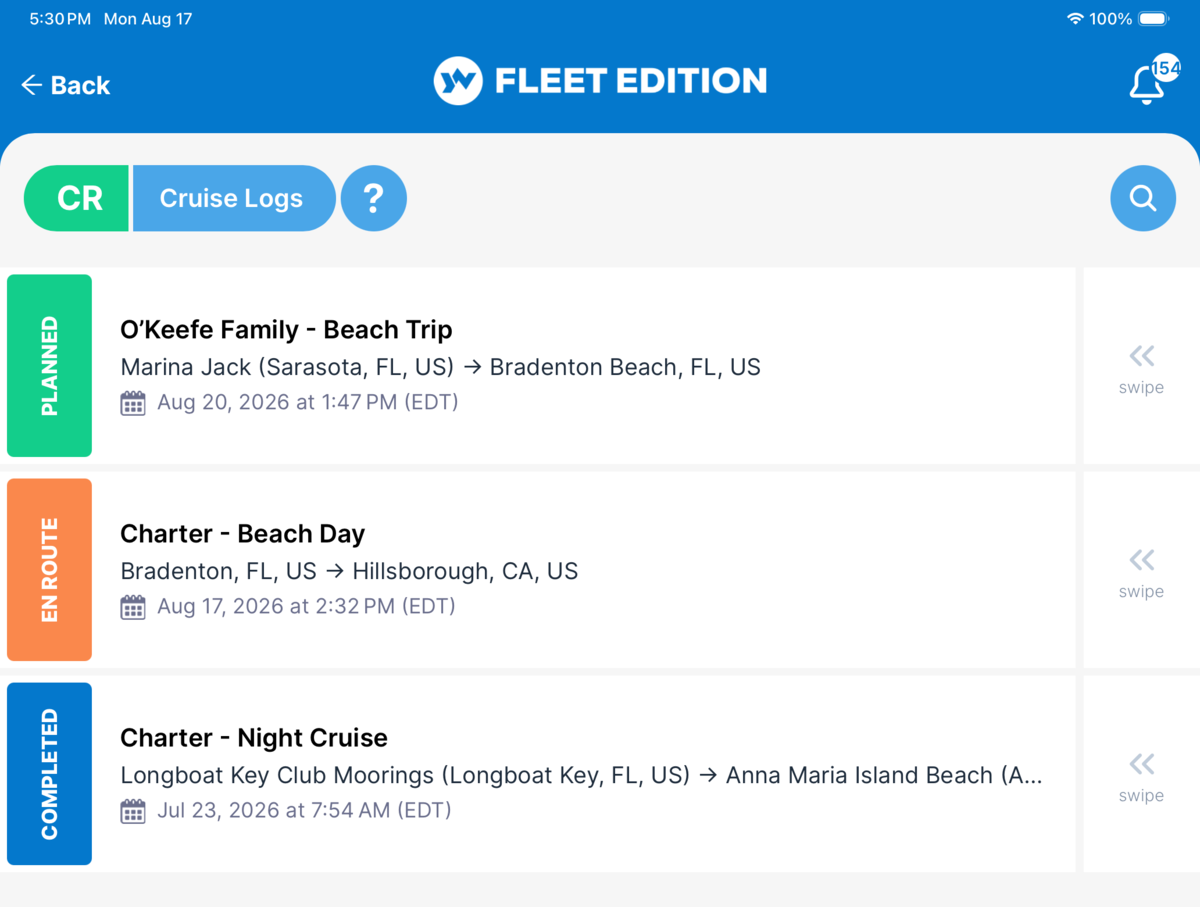
Cruise Logs
Every voyage from plan to completion — departure, waypoints, arrival — moving through Planned, En Route, and Complete. The trip you're considering next month and the one you finished last week live in the same list, in the state each is actually in.
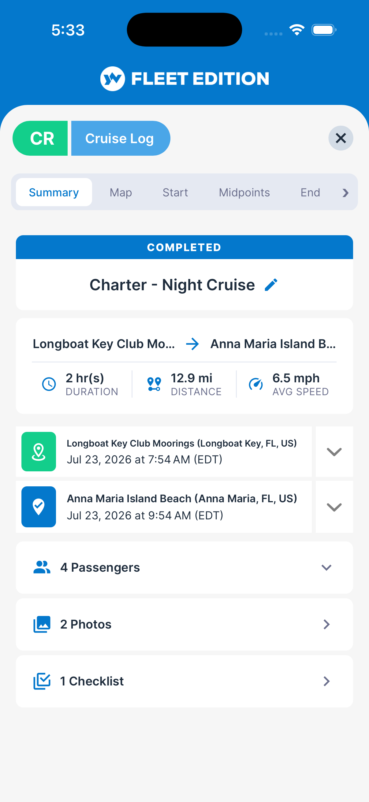
Voyage Summary
Distance travelled, duration, and average speed are computed from the waypoints as you enter them. It is the part of a logbook everyone gets wrong by hand, and the part nobody should be doing by hand.
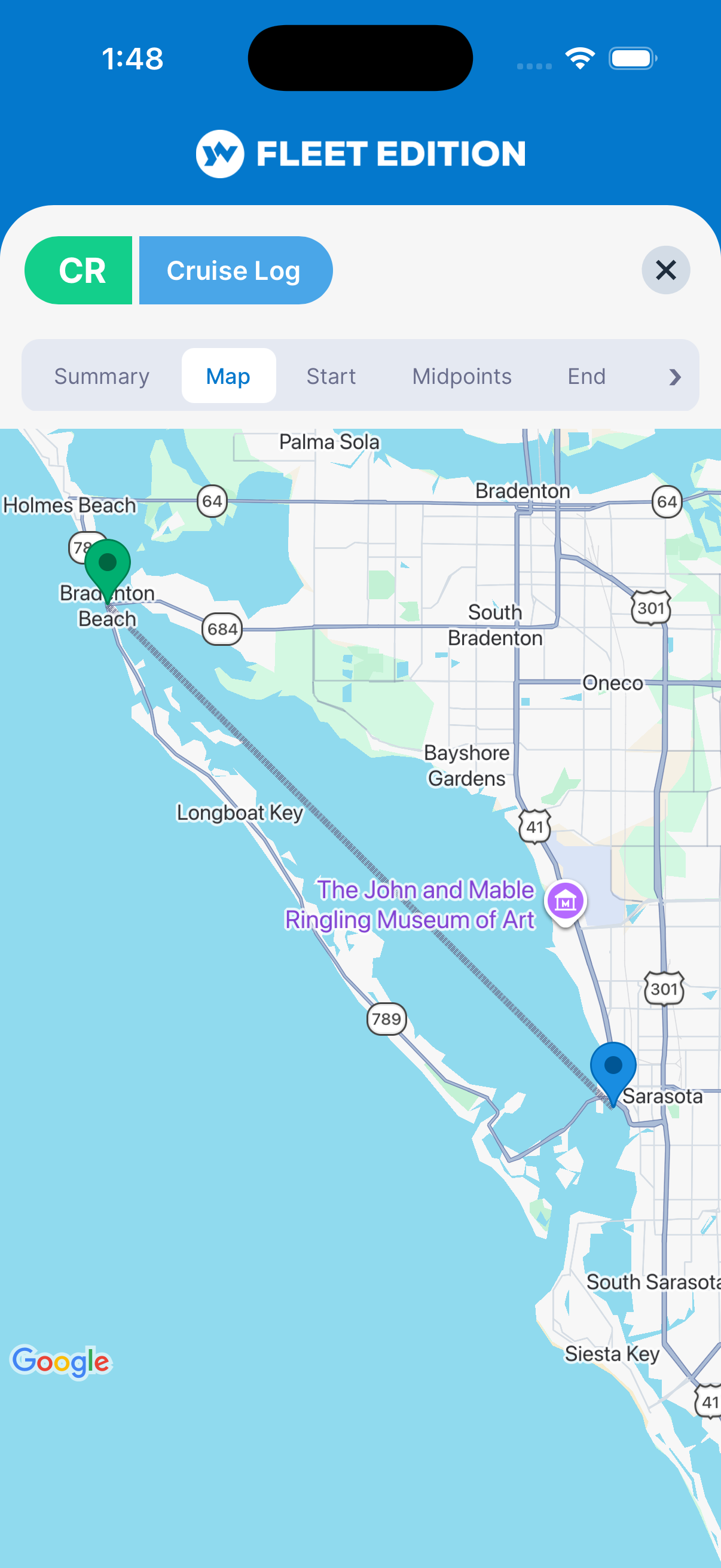
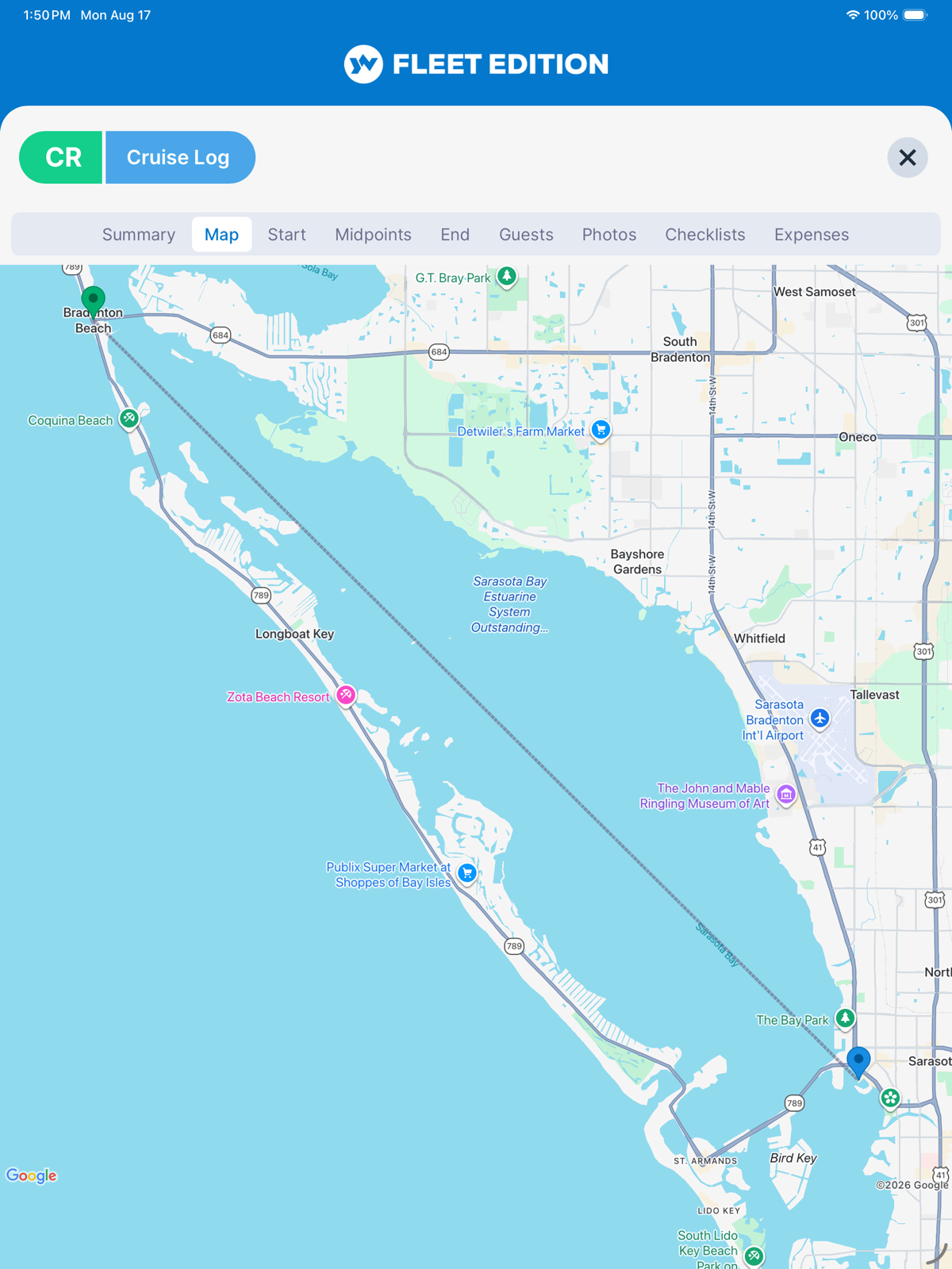
Trip Map Visualization
The whole voyage plotted — departure, every waypoint, arrival — so the passage reads at a glance instead of as a column of coordinates. Drop a pin and it resolves to the nearest marina or place; type a place and it resolves to coordinates.
Trip Recording Coming Soon
Recording the voyage as it happens, automatically — from a mobile device's GPS or from the YachtLINK™ device. Today the waypoints are yours to log; this is the step where the boat logs them for you.
What It Was Actually Like Out There
Pro & Ultimate
A position on its own says where the boat was. What makes a log worth keeping is everything recorded next to that position — the sea, the weather, and what the engines were doing at the time.
Waypoint Conditions & Readings
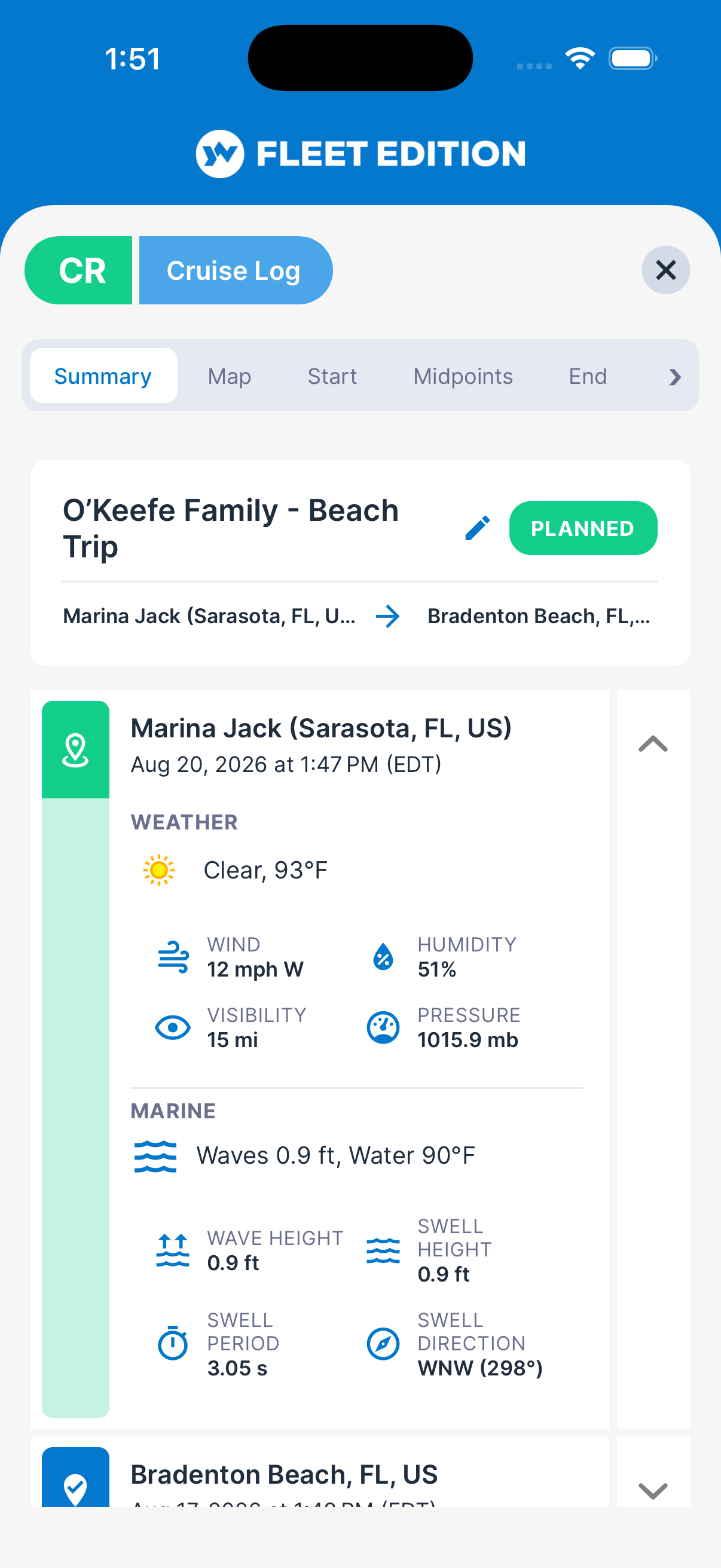
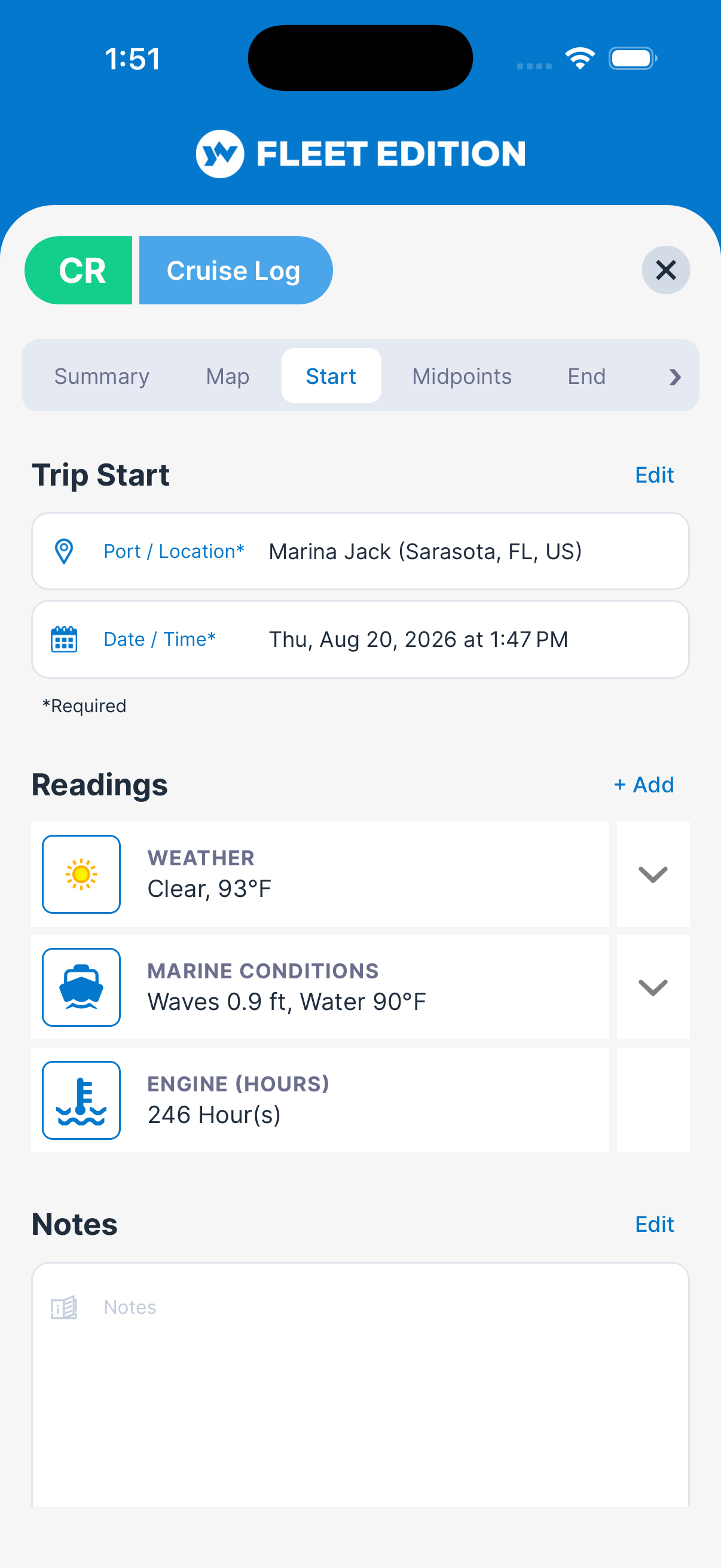
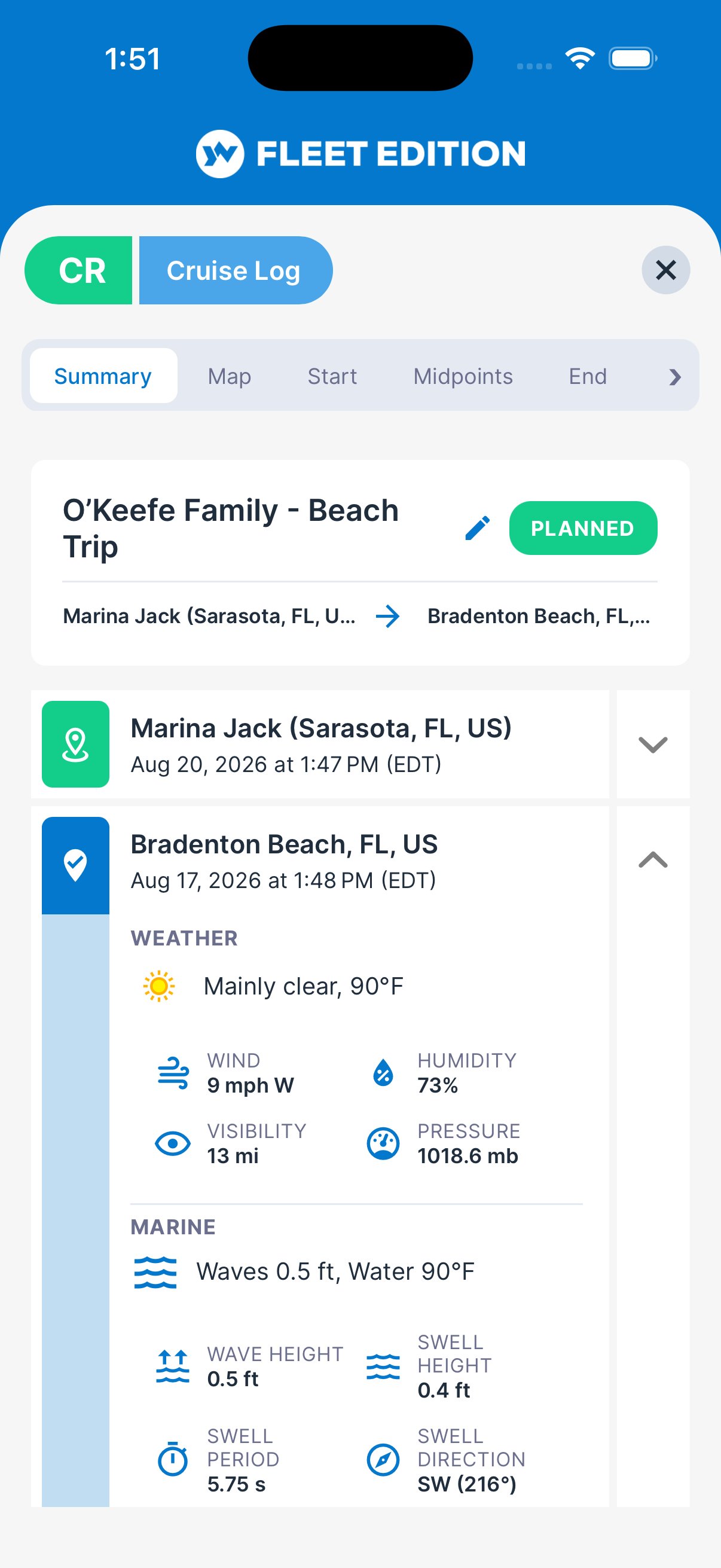
Wind, sea state, visibility, pressure, swell, and wave height captured at each stop, alongside engine and equipment readings taken at the same moment. One entry, one point on the chart, everything that was true there.
Weather Conditions
The weather the voyage actually saw, recorded along the route and kept with the cruise log permanently. Six months on, that is the difference between describing a rough afternoon and showing it.
Fuel and Hours That Reconcile
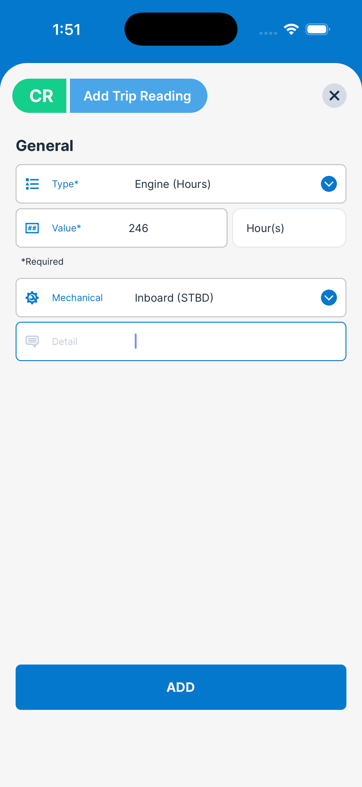
Because engine readings are logged at the waypoints, fuel state and hour-meter readings across a season line up against the passages that produced them — and the drift between what the meter says and what the boat did stops being a mystery at haul-out. More on Engines and Equipment →
Go or No-Go, Decided Before You Cast Off
Pro & Ultimate
The forecast that matters is not the one at the dock you're leaving. It's the one where you'll be in eleven hours, and the one at the anchorage you were planning to reach on Thursday.
Marine Forecasts for Trip Planning
Plan the trip before you leave: a 14-day forecast for every waypoint, with the marine data that actually decides go or no-go — wave height, swell, wind, and sea conditions, rather than a general outlook written for people on land.
A Forecast per Waypoint, Not per Trip
A passage can be comfortable at one end and unworkable at the other. Because the forecast is fetched for each point on the route, the decision you make is about the whole voyage — including whether to move a stop by a day.
Forecasts Anywhere You Cruise
Coverage is worldwide, not one coastline. The forecasts are built by combining more than 30 weather models from over 15 national weather services and meteorological organizations into a single source, which also holds historical weather back to 1940. The same 14-day waypoint forecast is there whether the route runs through the Bahamas, the Baltic, or the Sea of Japan.
Primary sources include ECMWF (Europe), NOAA (USA), the UK Met Office, Météo-France, DWD (Germany), KNMI (Netherlands), DMI (Denmark), MeteoSwiss, GeoSphere Austria, JMA (Japan), KMA (Korea), CMA (China), and Australia's Bureau of Meteorology.
Then the Forecast Becomes the Record
What was forecast before departure and what the boat actually met both stay attached to the same voyage. That pairing is what turns a defensible decision into a documented one — you can show what you knew when you chose to go.
The Record Somebody Will Ask You For
Pro & Ultimate
Charter authorities, insurers, and owners ask different questions about the same voyage. They are all answered from one record, because everything was attached to the trip while the trip was happening.
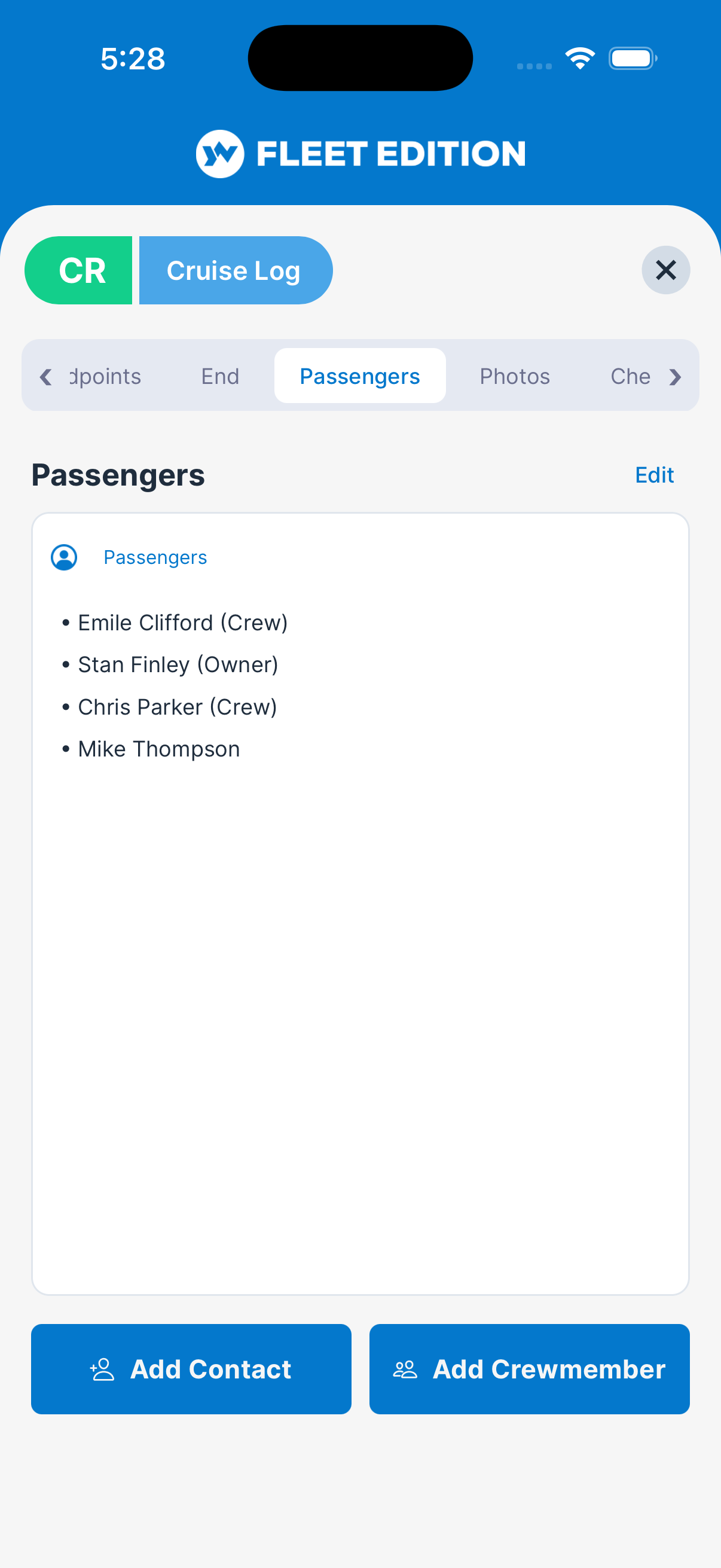
Passenger Manifest
Who was aboard, every trip — the record charter and insurance questions ask for, kept with the voyage rather than on a clipboard that went home with somebody.
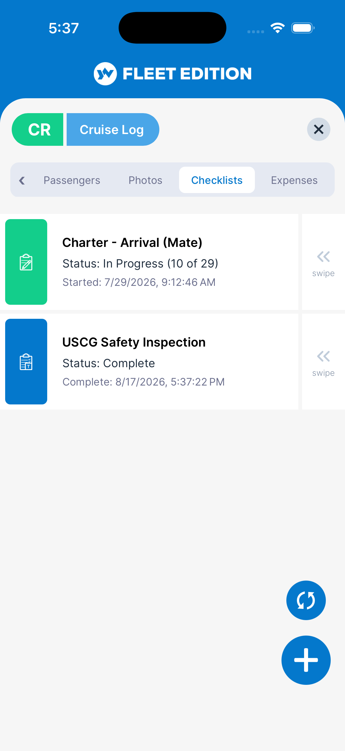
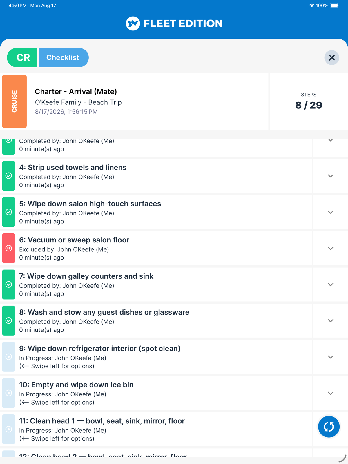
The Checklists You Ran, Kept With the Voyage
Departure and arrival procedures run against the trip itself, so the log shows not only where the boat went but that the boat was made ready before it went. More on Checklists →
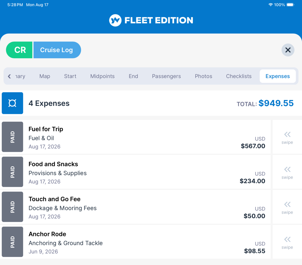
What the Voyage Cost
Fuel, dockage, and everything else booked to the trip as it was spent, so cost per voyage is a number you look up rather than assemble. Photograph the receipt at the fuel dock and it lands on this trip. More on Expense Tracking →
One Voyage, Not Four Systems
The checklists were already in YACHTWAVE, and so were the expenses — attaching them to a trip doesn't mean keeping them somewhere new, or entering them twice. That is the difference between a voyage record that is actually complete and one that was merely meant to be: nothing here depends on somebody remembering to copy it across afterwards.
Cruise logs, voyage summaries, trip maps, waypoint conditions and readings, marine forecasts, and the passenger manifest are part of the Pro and Ultimate editions. Trip Recording — logging the voyage automatically from a mobile device or the YachtLINK™ device — is coming soon.
Compare Every Feature, Edition by Edition →
Log the Voyage While You're On It
The track, the conditions, the manifest, and the cost — recorded as they happen, kept with the voyage, and waiting six months later when somebody asks.
CONTACT US